Online Maps
Access online maps that allow you to view layers, search for locations, and view features.
On this page
Community maps


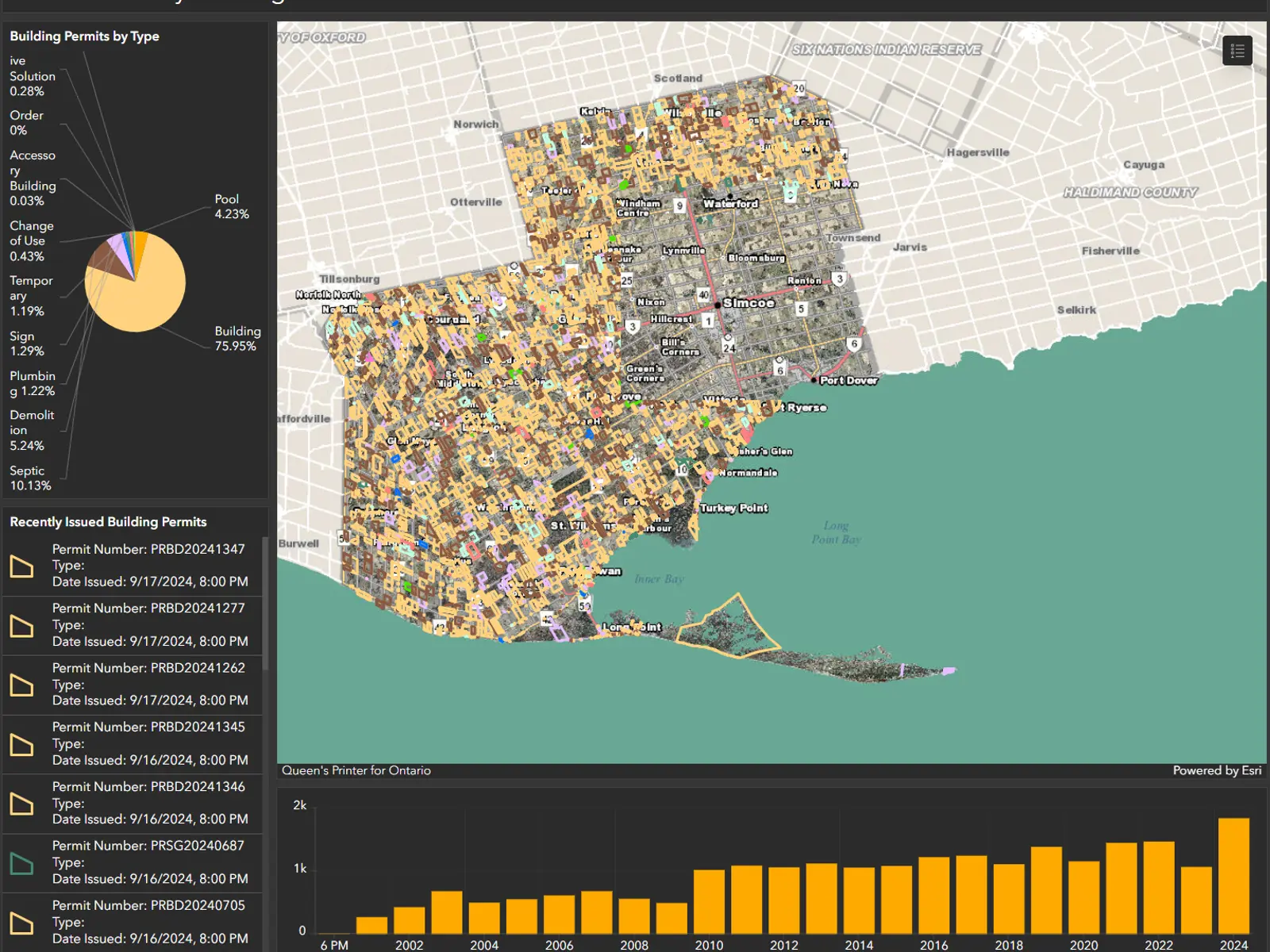
Building and Development maps


Recreation and culture maps


Online mapping links
- Ontario Petroleum Wells – Oil, Gas & Salt Resource Library (ogslibrary.com)
- Ontario Ground Water Wells – Oil, Gas & Salt Resource Library (ogslibrary.com)
- Make A Topo Map – Ontario Ministry of Natural Resources and Forestry (ontario.ca)
- Source Water Protection Information Atlas – Ontario Ministry of Environment, conservation and Parks (ontario.ca)
- Ontario Cosine Viewer – Provincial Geodetic Control Points, maintained by The Ministry of Natural Resources and Forestry (ontario.ca)
About our maps
For questions concerning any of these applications, please contact NorfolkGIS@norfolkcounty.ca .
Please note that application speed and loading time depend on the speed of your connection and the amount of data requested. Be aware that there will be times when these applications are not reachable due to scheduled maintenance.
Contact Us
ServiceNorfolk
50 Colborne Street South
Simcoe, Ontario
N3Y 4H3
Phone: 519-426-5870 or 226-NORFOLK, extension 0


